


Horseytalk.net/Hoofbeat EXCLUSIVE
RIDER RIGHTS
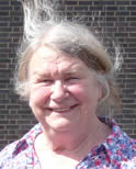
Says Adrienne Yentis
 A friend of mine recently was riding on the heath
and she came across a group of cattle strung out across the bridlepath with no way through – the only way off was to turn round. Fortunately her horse
remained calm throughout. But you can imagine how a nervous horse might react ........... read more
A 325 Road Works: How they will affect horse and rider
Maureen Comber writes to Hampshire County Council
Proposals for safer crossings
Says Maureen Comber
 Hello Louise,
Thank you for getting in touch and a particular thank you to Kathie for raising the issue of horse riders who perennially seem to be overlooked however hard we try. In fact I have not bothered to attend the last two Standing Conferences because even though I have sat on the Infrastructure, Transport and Education Steering Committee, and Specialist Advisory Groups since their inception, also as the nominated representative.
It was me who initially suggested the 'green grid' to connect the common land so that the wildlife can move around without getting squashed, also useful as bridleways of course, but this was soon taken over as walking and cycling and however many times I asked for horse riders to be included, they simply weren't, so I saw no point in wasting my time further. I was therefore pleasantly surprised to receive your telephone call yesterday.
There is much we can contribute for access to the commons, open spaces and Alice Holt Forest which are all areas of importance for 'air and exercise' and recreation for the public, particularly as some of these are in or border the South Downs National Park. Since sec.30 Countryside Act 1968 permits access by cyclists to bridleways, they are useful for all non-motorised users although of course this law states that cyclists must give way to walkers and horse riders!
Bordon and Whitehill are sitting in the middle of Woolmer Forest which is mostly common land. I have been asking John Carter the Chair for the Delivery Board and Steve Pearce the town Manager, plus the so called landowners = EHDC, HCC, MOD for a map of who owns what and the status of the land owned. To date this has not been forth coming. It is vitally important because as can been seen from the Inclosure Award for Woolmer Forest 1847, a huge amount of the land in and around Whitehill/Bordon is common land and by law cannot be built on!
The situation has been confused because the common land was originally 'vested' with the Crown before being handed over to the MOD and/or HCC. The MOD are a law unto themselves and can do what they like without planning permission, until that is, they no longer have a military use for the land, at which point it has to be cleared and returned to common land.
This is obvious really because it has never received any planning permission and the common rights over it have been suspended. That is the law and that is why it is important to identify the land held by the 'landowners' and the status of it, but particularly the MOD as the largest of them. So the proposed relief road may well run over common land, in which case it will have to gain permission from the commoners first and then the public, who will have a right of access for 'air and exercise', before an application can be made to the Secretary of State.If he were minded to give permission, then HCC as the applicant would have to find the same amount of exchange land to replace the land being taken for whatever, in this case the relief road. I have to say we are still waiting for the exchange land taken by HCC for the Lindford Sports Club on the edge of Broxhead Common.!!
Please note that I said the land was but 'vested' with the MOD or local authority. That is a bit different to ownership in that it only gives jurisdiction for protection of the land from encroachment such as fencing or buildings etc., and although it can be bought and sold the rights of the commoners remain paramount to the produce of the land, whether those rights have been suspended by Military requisition or not. This is the reason why common land is not terribly valuable.
Nevertheless that does not mean we cannot get on and consider new bridleways or for that matter paths which already exist and should be on the definitive Map but aren't. Lost ways if you like.
The first of these is in the Woolmer Forest Inclosure Awards 1857. I have attached the award and map. It could be that it runs very close to the proposed relief road but you would need to help me identify it. The second is Oxney Lane which is just north of Louisberg Barracks and runs from the A325 to Kingsley. This needs to be upgraded to bridleway from FP because the historic records show it could be either. It also needs a spur along the edge of the parade ground behind Louisberg, to link to the old railway line so that it can continue south and west to Oakhanger and Selborne or north to Kingsley. It would really be great if we could by this means join up all the commons. Good for wildlife too. I will attach some of the historical records FYI.
Perhaps we could look at these for a start but I will circulate your message to local people who I think might be interested so that they can let me know what is on their 'wish list'. Thanks again for getting in touch. I do hope we can help to make the countryside more available and enjoyable for non-motorised use as well as the movement of wildlife, so as to prevent the new town from becoming an obstruction to anyone or anything not in a motor vehicle. Sadly, as I told you on the telephone, it has been many years since I was able to access my home village of Kingsley on horse back because it is like playing Russian roulette trying to cross the A325 at Frith End or Sleaford. Just too scary so the road has for too many years been a cause for community severance as of course it is not just me that has been impeded.
I have attached my letter (2003) to Hampshire County Council for various crossing points on the A325 as promised.
Sincerely Maureen Comber
BHS Hants CABO
 Says Linda Wright
We moved to a Shropshire location a year ago having surveyed the local OS map and noted the significant number of bridleways around the property. Sadly the map appears a total fiction. Scarce any of the bridleways are usable ........... read more